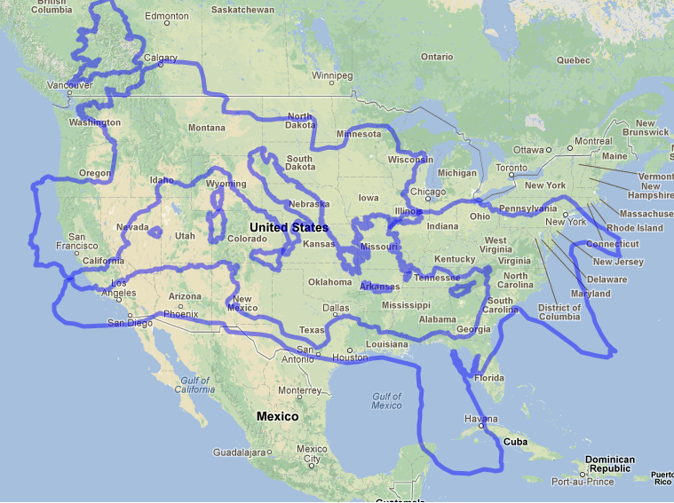
My favorite is this map comparing the size of Rome with the size of the continent US:
"The Roman provinces of Britain and Egypt were about as far apart as the American states of Florida and Washington. One obvious difference is that the Roman empire had the Mediterranean in the middle of it, which helped to move people and supplies over vast distances. Still, it's remarkable that emperors operating many centuries before the railroad and the telegraph — to say nothing of airplanes and the internet — were able to hold together such a vast domain for so long."